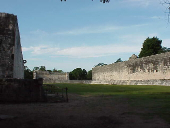
This is a view of the Ball Court looking south-south-west. The ball court is 150 meters (approx. 450 feet) long. The top of the wall is perhaps 8 meters (24 feet) high. It is 35 meters (100 feet) from side to side. If you clap your hands, there is a repeated echo. I have been told by people who counted, it echos 7 times. I yelled, but I did not experience the same number of echos. Instead, it seemed to be more of a reverberation.

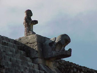
At the ends of the side walls of the Ball Court are serpant heads. This is the one at the north end of the east wall.
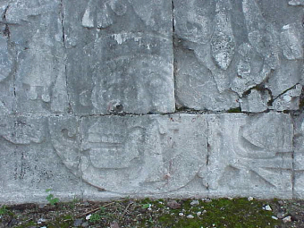
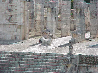
This is a skull which is on the lower wall of the Ball Court.
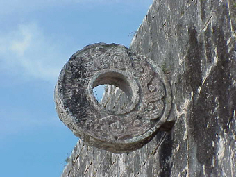
This is an isolated view of the ring on the Ball Court's west wall. At almost 8 meters (22 feet) above the ground, it is amazing that players could get something through this ring only using their elbows, knees and hips.
This is a close-up of the ring in the north wall.
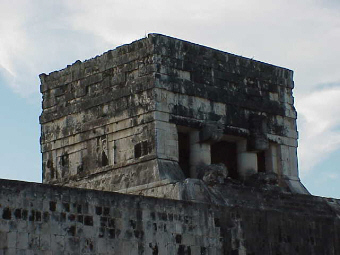
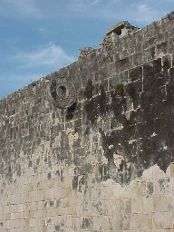
This is the tower on top of the east wall of the Ball Court.
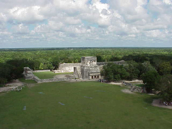
This view of the Ball Court was taken from the top of Kukulcan looking northwest. Part of the Platform of the Jaguars and Eagles is in the bottom right of the picture.
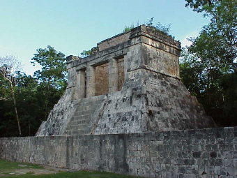
This is the Temple of the Bearded Man at the north end of the Ball Court.

This gives you a better look at the Bearded Man Temple.
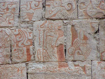
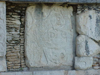
This is a close-up of the carvings in the Temple of the Bearded Man.
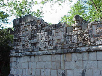
Walking around the north end of the Ball Court you come to what is often called the Platform of the Jaguars and Eagles.

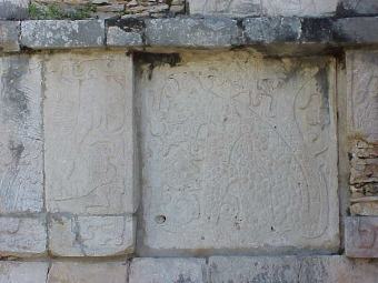
One of the walls of the Platform is covered with carvings of different skulls.
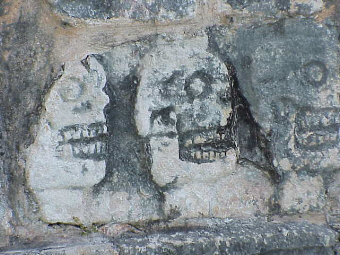
This is a close-up of some of the skulls.
This is a close-up of one of the jaguars.
Here is another jaguar.
This is Kukulcan from the Platform of the Jaguars.
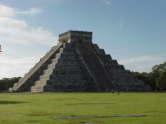
This is a more close-up version from the same angle looking south-south-east.
This is from the Temple of the Warriors looking south-south-west.
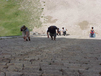
The pyramid is quite steep. I took this picture from the top looking down at some people climbing up. You can really appreciate how steep it is.
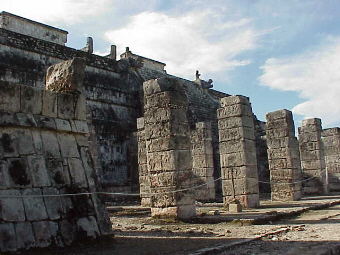
Just east-north-east of the Pyramid is the Temple of the Warriors and the Thousand Columns. Most people know of this site as the location where human sacrafices were performed. This took place on the upper level of the structure, atop a carving of the god Chac-mool. To preserve this area, the platform area with Chac-mool is now closed to the public.
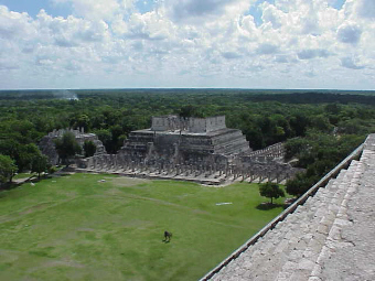
This is a view of both structures with Kukulcan in the foreground.
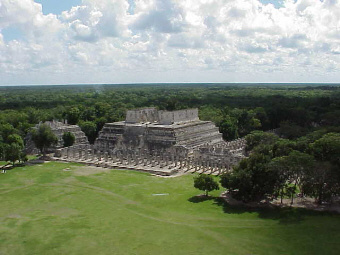
This is both structures taken from the top of Kukulcan.
The reclining figure in the middle is Chac-mool, also taken from the top of Kukulcan.
This shot was taken from ground level, looking almost due south.
Tis is a close-up of the carvings on the top platform taken from the same place.
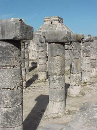
This picture of some of the Thousand Columns shows Kukulcan in the background.
This picture shows some of the detailed building structures in the southeastern end of the complex.
The Maya often build raised roads through the jungle called Sacbes. They often were many feet wide and were elevated from the jungle below by several feet. A Cenote is a natural sinkhole which developes in the limestone of the Yucatan peninsula. They were often used as a source of water. They are still used as swimming holes in modern times.
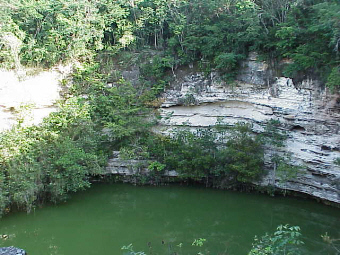
300 meters north of the Platform of the Jaguars and Eagles and the main plaza is a sacbe which leads to the Sacred Cenote. It is 60 meters wide (195 feet), 24 meters (72 feet) to the water lever, and approximately 13 meters (40 feet) deep. The water is very green.
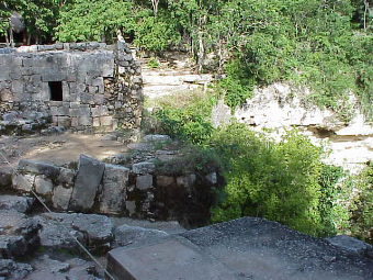
This is a structure at the south end of the Cenote.
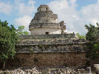
Many people know the Maya were quite advanced in their astronomical abilities. The structure called the Caracol (snail) by the Spanish, and the Observatory by others, was believe to be the scene of some of their observations. Most of this structure as been closed to the public.
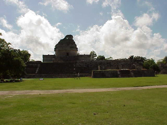
This view is looking east-south-east (hence the glare).

A more detailed view of the Observatory.
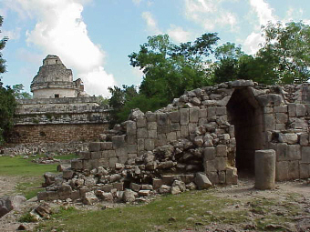
This is looking north-north-east with either the steambaths or the Temple of the Wall Panels in the foreground.
This is a closer view looking north-north-east.
Just south of the Observatory is a building called the Nunnery. It has an excellent example of the Maya practice of building a new building on top of an older one.
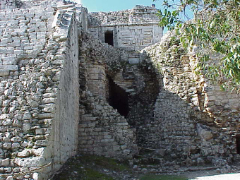
The rounded corner in the middle of this picture was once the top most building. Eventually, it was covered by another structure.
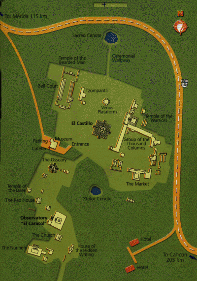
Below is a map of the ruins.
Click here for the Main Page (Page 1)
Click here for Kabah (Page 3)
Click here for Uxmal (Page 4)
Click here for Labna, Xlapak and Sayil (Page 5)
Click here for Palenque (Page 6)
Click here for Xpujil, Becan and Museo de la Cultura Maya (Page 7)
Click here for Travel Tips & Bus Info (Page 8)
Phil Konstantin
mayatrip@americanindian.net
P.O.BOX 17515
SAN DIEGO, CA 92177-7515
United States
This page has been visited times, since July 23, 2001.
Click here to return to my Main Page: "On This Date in North American Indian History."
maya, ruins, yucatan, uxmal, xpujil, xpuhil, chichen itza, palenque, merida, quintana roo, chiapas, coba, rio bec, chinanna, becan, mexico, cancun, tulum, kabah, sayil, labna, tribe, tribal, name, Indian, american indian, native american, americanindian, first people, Cherokee, Phil Konstantin